Command Palette
Search for a command to run...
Landslide4Sense Landslide Remote Sensing Benchmark Dataset
Date
Size
Organization
Paper URL
License
MIT
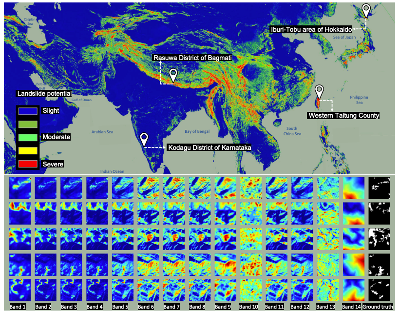
Landslide4Sense is a multi-source satellite remote sensing benchmark dataset for landslide detection released by IARAI in 2022. It is also the official dataset for the Landslide4Sense competition. The related paper results are "The Outcome of the 2022 Landslide4Sense Competition: Advanced Landslide Detection from Multi-Source Satellite Imagery".
This dataset covers landslide scenes from multiple regions from 2015 to 2021. The dataset is organized into 128×128 image blocks with a resolution of approximately 10 m/pixel. Each sample contains 14 bands (Sentinel-2 multispectral B1–B12 + ALOS PALSAR-derived slope and DEM). The data is divided into training, validation, and test sets, with 3,799, 245, and 800 samples, respectively. The data also provides pixel-level binary masks (landslide = 1, non-landslide = 0). Labels are only publicly available for the training set; the validation and test sets are used for ranking evaluation.
Build AI with AI
From idea to launch — accelerate your AI development with free AI co-coding, out-of-the-box environment and best price of GPUs.